Difference between revisions of "Mary's River Mine"
Jump to navigation
Jump to search

| (One intermediate revision by the same user not shown) | |||
| Line 1: | Line 1: | ||
| − | {{Navbar-Global Coal Mine Tracker}} '''Mary's River Mine''' (also '''Marys River Mine''') was a proposed U.S. surface coal mine in Randolph County, Illinois, by [[Peabody Energy|Peabody Energy's]] Peabody Midwest Mining.<ref>[ | + | {{Navbar-Global Coal Mine Tracker}} '''Mary's River Mine''' (also '''Marys River Mine''') was a proposed U.S. surface coal mine in Randolph County, Illinois, by [[Peabody Energy|Peabody Energy's]] Peabody Midwest Mining.<ref name=redorbit>[http://www.redorbit.com/news/entertainment/547560/illinois_coal_is_on_a_comeback/index.html "Illinois Coal Is on a Comeback"] RedOrbit.com, June 22, 2006.</ref> As of November 2019, the project has not progressed in more than four years and appears to be cancelled. |
==Location== | ==Location== | ||
| − | The below map shows the approximate location | + | The below map shows the approximate location where the mine would have been built in Randolph County, Illinois. |
{{#display_point: 38.029030,-89.666907|width=600|height=500|type=normal|zoom=13}} | {{#display_point: 38.029030,-89.666907|width=600|height=500|type=normal|zoom=13}} | ||
| Line 11: | Line 11: | ||
*'''GPS Coordinates:''' 38.029030, -89.666907 (approximate) | *'''GPS Coordinates:''' 38.029030, -89.666907 (approximate) | ||
*'''Status:''' Cancelled | *'''Status:''' Cancelled | ||
| − | *'''Production Capacity:''' 1 million tons per year | + | *'''Production Capacity:''' 1 million tons per year (proposed)<ref name=redorbit></ref> |
*'''Total Resource:''' | *'''Total Resource:''' | ||
*'''Mineable Reserves:''' | *'''Mineable Reserves:''' | ||
*'''Coal Type:''' | *'''Coal Type:''' | ||
| − | *'''Mine Size:''' 709 acres | + | *'''Mine Size:''' 709 acres<ref name=redorbit></ref> |
*'''Mine Type:''' | *'''Mine Type:''' | ||
| − | *'''Start Year:''' 2011 (proposed) | + | *'''Start Year:''' 2011 (proposed)<ref name=redorbit></ref> |
*'''Source of Financing:''' | *'''Source of Financing:''' | ||
Latest revision as of 19:55, 26 November 2019
| This article is part of the Global Coal Mine Tracker, a project of Global Energy Monitor and the Center for Media and Democracy. |
| Sub-articles: |
Mary's River Mine (also Marys River Mine) was a proposed U.S. surface coal mine in Randolph County, Illinois, by Peabody Energy's Peabody Midwest Mining.[1] As of November 2019, the project has not progressed in more than four years and appears to be cancelled.
Contents
Location
The below map shows the approximate location where the mine would have been built in Randolph County, Illinois.
Project Details
- Sponsor: Peabody Midwest Mining
- Parent Company: Peabody Energy
- Location: Randolph County, Illinois, United States
- GPS Coordinates: 38.029030, -89.666907 (approximate)
- Status: Cancelled
- Production Capacity: 1 million tons per year (proposed)[1]
- Total Resource:
- Mineable Reserves:
- Coal Type:
- Mine Size: 709 acres[1]
- Mine Type:
- Start Year: 2011 (proposed)[1]
- Source of Financing:
Articles and resources
Related SourceWatch articles
- Coal and jobs in the United States
- Coal phase-out
- Headquarters of U.S. coal mining companies
- Global list of coal mining companies and agencies
- Proposed coal mines
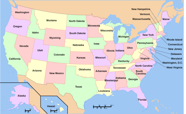
To see a listing of coal mines in a particular state, click on the map:
References
- ↑ Jump up to: 1.0 1.1 1.2 1.3 "Illinois Coal Is on a Comeback" RedOrbit.com, June 22, 2006.


