Difference between revisions of "Buckskin Mine"
(SW: map) |
Adrianwilson (talk | contribs) (edits) |
||
| Line 1: | Line 1: | ||
| − | {{#badges:CoalSwarm|Navbar-PBRMines}} '''Buckskin Mine''' is a | + | {{#badges:CoalSwarm|Navbar-PBRMines}}'''Buckskin Mine''' is a coal mine in Wyoming, United States. |
| − | + | ==Location== | |
| + | The map below shows the location of the mine, near Gillette, in Campbell county, Wyoming. | ||
| + | {{#display_point:44.4742,-105.5395|width=600|height=500|type=hybrid|zoom=13}} | ||
| − | + | ==Background== | |
| + | Buckskin Mine is a surface coal mining operation in Campbell County, Wyoming, operated by Kiewit Mining Group and owned by Kiewit Peter Sons. | ||
| + | |||
| + | As of May 2010, the U.S. Bureau of Land Management is considering issuing a coal lease to Kiewit Mining to extend the life of the mine. The consideration is the result of a March 24, 2006, application made by Kiewit Mining Properties, Inc. to lease the [[Federal coal leasing|Federal coal]] in the Hay Creek II Tract, northwest of the Buckskin Mine and approximately 12 miles north of Gillette, Wyoming. The Hay Creek II Tract contains 419.04 acres, and Kiewit estimates that the current tract includes approximately 54.1 million tons of recoverable coal.<ref>[http://edocket.access.gpo.gov/2010/2010-5257.htm "Notice of Availability and Notice of Hearing for the Buckskin Mine Hay Creek II Coal Lease by Application Draft Environmental Impact Statement, WY"] E-docket, March 12, 2010.</ref> | ||
| + | |||
| + | In the mid-2010's, the mine's production began declining dramatically — and along with it the mine's employment, which went from 365 in 2012 to 177 in March 2016.<ref>[https://trib.com/business/energy/buckskin-mine-lays-off-as-coal-jobs-continue-to-disappear/article_fc45b6cc-7218-57f4-9dc5-84160b3d5df9.html Buckskin Mine lays off 45, as coal jobs continue to disappear], ''Casper Star Tribune'', 14 June 2016.</ref> The mine's recoverable reserves were at 344 million tons in 2008; with production of 13–26 million tons per year since then, the mine is likely reaching the end of its lifetime.<ref>[https://miningdataonline.com/property/1228/Buckskin-Mine.aspx Buckskin Mine], Mining Data Online, accessed June 2019.</ref> | ||
==Mine Data== | ==Mine Data== | ||
| Line 12: | Line 19: | ||
*'''County:''' Campbell | *'''County:''' Campbell | ||
*'''State:''' WY | *'''State:''' WY | ||
| − | *'''Latitude:''' 44. | + | *'''Latitude:''' 44.4742 |
| − | *'''Longitude:''' -105. | + | *'''Longitude:''' -105.5395 |
*'''2007 Production (short tons):''' 25,268,145 | *'''2007 Production (short tons):''' 25,268,145 | ||
*'''Coal Type:''' Bituminous | *'''Coal Type:''' Bituminous | ||
Revision as of 08:52, 23 June 2019
{{#badges:CoalSwarm|Navbar-PBRMines}}Buckskin Mine is a coal mine in Wyoming, United States.
Contents
Location
The map below shows the location of the mine, near Gillette, in Campbell county, Wyoming.
Background
Buckskin Mine is a surface coal mining operation in Campbell County, Wyoming, operated by Kiewit Mining Group and owned by Kiewit Peter Sons.
As of May 2010, the U.S. Bureau of Land Management is considering issuing a coal lease to Kiewit Mining to extend the life of the mine. The consideration is the result of a March 24, 2006, application made by Kiewit Mining Properties, Inc. to lease the Federal coal in the Hay Creek II Tract, northwest of the Buckskin Mine and approximately 12 miles north of Gillette, Wyoming. The Hay Creek II Tract contains 419.04 acres, and Kiewit estimates that the current tract includes approximately 54.1 million tons of recoverable coal.[1]
In the mid-2010's, the mine's production began declining dramatically — and along with it the mine's employment, which went from 365 in 2012 to 177 in March 2016.[2] The mine's recoverable reserves were at 344 million tons in 2008; with production of 13–26 million tons per year since then, the mine is likely reaching the end of its lifetime.[3]
Mine Data
- MSHA ID: 4801200
- Operator: Kiewit Mining Group
- Controller: Kiewit Peter Sons' Inc
- Union:
- County: Campbell
- State: WY
- Latitude: 44.4742
- Longitude: -105.5395
- 2007 Production (short tons): 25,268,145
- Coal Type: Bituminous
- Mining Method: Surface
- Mine Status: Active
- Average No. of Employees: 253
Articles and resources
Related SourceWatch articles
- Wyoming and coal
- U.S. coal politics
- Coal and jobs in the United States
- Coal phase-out
- Headquarters of U.S. coal mining companies
- Global list of coal mining companies and agencies
- Proposed coal mines
- Existing U.S. Coal Plants
- Coal
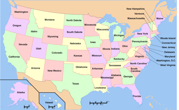
To see a listing of coal mines in a particular state, click on the map:
References
- ↑ "Notice of Availability and Notice of Hearing for the Buckskin Mine Hay Creek II Coal Lease by Application Draft Environmental Impact Statement, WY" E-docket, March 12, 2010.
- ↑ Buckskin Mine lays off 45, as coal jobs continue to disappear, Casper Star Tribune, 14 June 2016.
- ↑ Buckskin Mine, Mining Data Online, accessed June 2019.
External links
- "Major U.S. Coal Mines," Energy Information Administration

