Difference between revisions of "Buckskin Mine"
(SW: →External links: added category) |
|||
| (8 intermediate revisions by 4 users not shown) | |||
| Line 1: | Line 1: | ||
| − | {{ | + | {{Navbar-Global Coal Mine Tracker}}'''Buckskin Mine''' is a surface coal mining operation in Campbell County, Wyoming, operated by [[Kiewit Mining Group]] and owned by [[Kiewit Corporation]]. |
| − | + | ==Location== | |
| + | The below satellite image shows the location of the mine near Gillette, in Campbell County, Wyoming. | ||
| + | {{#display_point:44.4742,-105.5395|width=600|height=500|type=hybrid|zoom=13}} | ||
| − | + | ==Background== | |
| + | Buckskin Mining Company is located 10 miles north of Gillette, Wyoming, within the Southern Powder River Basin.<ref name=k>[https://www.kiewit.com/projects/mining/owned-operations/buckskin-mining-company/ Buckskin Mining Company] Kiewit, accessed October 2019.</ref> The mine produces around 27 million tons of coal per year from the Anderson and Canyon Seams located within the Fort Union Formation. Since 1981, Buckskin has shipped more than 406 million tons of high-quality, low sulfur coal from the Southern Powder River Basin.<ref name=k/> | ||
| − | ==Mine | + | Buckskin Mine has achieved notable success for its reclamation program. In 1997, the mine (which was owned by Triton Coal Company at that time) won an award from the U.S. Department of the Interior for its efforts to restore the Rawhide Creek alluvial valley floor which involved replacing topsoil on the alluvial valley floor following all mining operations in the area.<ref name=k/><ref>[https://www.osmre.gov/programs/awards/ActiveWinners.shtm Excellence in Surface Coal Mining Reclamation Awards Winners: Active Mine Awards] Office of Surface Mining Reclamation and Enforcement, accessed October 2019.</ref> |
| − | + | ||
| − | *''' | + | ===Mine Lifespan=== |
| − | *''' | + | In 2010, the U.S. Bureau of Land Management (BLM) considered issuing a coal lease to Kiewit to extend the life of the mine. The consideration was the result of a March 2006 application made by Kiewit to lease the [[Federal coal leasing|Federal coal]] in the Hay Creek II Tract, northwest of the Buckskin Mine and approximately 12 miles north of Gillette, Wyoming. The Hay Creek II Tract contains 419.04 acres, and Kiewit estimated that the current tract included approximately 54.1 million tons of recoverable coal.<ref>[http://edocket.access.gpo.gov/2010/2010-5257.htm "Notice of Availability and Notice of Hearing for the Buckskin Mine Hay Creek II Coal Lease by Application Draft Environmental Impact Statement, WY"] E-docket, March 12, 2010.</ref> In September 2013, the BLM rejected a bid submitted by Kiewit Mining Properties on behalf of its subsidiary, Buckskin Mining, for the Hay Creek II coal lease tract because the bid did not meet BLM’s secret estimate of the tract’s fair market value.<ref>[https://www.transmissionhub.com/articles/2013/09/blm-rejects-kiewits-35-1m-bid-for-new-buckskin-coal-tract.html "BLM rejects Kiewit's $35.1m bid for new Buckskin coal tract"] Transmission Hub, Sept. 19, 2013.</ref> As of November 2019, the project has not progressed in more than four years and appears to be cancelled. |
| − | *''' | + | |
| − | *''' | + | In the mid-2010s, the mine's production began declining dramatically—and along with it the mine's employment, which went from 365 in 2012 to 177 in March 2016.<ref>[https://trib.com/business/energy/buckskin-mine-lays-off-as-coal-jobs-continue-to-disappear/article_fc45b6cc-7218-57f4-9dc5-84160b3d5df9.html "Buckskin Mine lays off 45, as coal jobs continue to disappear"], Casper Star Tribune, 14 June 2016.</ref> The mine's recoverable reserves were at 344 million tons in 2008; with production of 13–26 million tons per year since then, the mine could reach the end of its lifespan by the year 2022.<ref>[https://miningdataonline.com/property/1228/Buckskin-Mine.aspx Buckskin Mine], Mining Data Online, accessed June 2019.</ref> |
| − | *''' | + | |
| − | *''' | + | ==Project Details== |
| − | *''' | + | *'''Sponsor:''' Kiewit Mining Group |
| − | *''' | + | *'''Parent Company:''' Kiewit Corporation |
| − | *'''Coal Type:''' Bituminous | + | *'''Location:''' Campbell County, Wyoming, United States |
| − | *''' | + | *'''GPS Coordinates:''' 44.4742, -105.5395 (exact) |
| − | *''' | + | *'''Status:''' Operating |
| − | *''' | + | *'''Production Capacity:''' 27 million tons per year<ref name=k/> |
| + | *'''Total Reserves:''' | ||
| + | *'''Mineable Reserves:''' 344 million tons | ||
| + | *'''Coal Type:''' Bituminous | ||
| + | *'''Mine Size:''' | ||
| + | *'''Mine Type:''' Surface | ||
| + | *'''Start Year:''' 1981 | ||
| + | *'''Source of Financing:''' | ||
| + | |||
| + | ==Project Expansion Details== | ||
| + | *'''Status:''' Cancelled | ||
| + | *'''Production Capacity:''' | ||
| + | *'''Mineable Reserves:''' 167 million tons<ref>[https://www.transmissionhub.com/articles/2013/05/new-coal-reserve-for-kiewits-buckskin-mine-nears-a-blm-auction.html "New coal reserve for Kiewit's Buckskin mine nears a BLM auction"] Transmission Hub, May 7, 2013.</ref> | ||
| + | *'''Mine Expansion Size:''' 1,253 acres | ||
| + | *'''Start Year:''' | ||
| + | *'''Source of Financing:''' | ||
==Articles and resources== | ==Articles and resources== | ||
| Line 33: | Line 51: | ||
To see a listing of coal mines in a particular state, click on the map: | To see a listing of coal mines in a particular state, click on the map: | ||
| − | + | {{USA imagemap state names proposed coal plants}} | |
==References== | ==References== | ||
| Line 41: | Line 59: | ||
* [http://www.eia.doe.gov/cneaf/coal/page/acr/table9.html "Major U.S. Coal Mines,"] Energy Information Administration | * [http://www.eia.doe.gov/cneaf/coal/page/acr/table9.html "Major U.S. Coal Mines,"] Energy Information Administration | ||
| − | + | [[Category: Existing coal mines in the United States]] [[Category: Coal Issues]] | |
| − | [[Category: Existing coal mines in the United States]] | ||
| − | [[Category: | ||
| − | |||
Latest revision as of 20:11, 6 November 2019
| This article is part of the Global Coal Mine Tracker, a project of Global Energy Monitor and the Center for Media and Democracy. |
| Sub-articles: |
Buckskin Mine is a surface coal mining operation in Campbell County, Wyoming, operated by Kiewit Mining Group and owned by Kiewit Corporation.
Contents
Location
The below satellite image shows the location of the mine near Gillette, in Campbell County, Wyoming.
Background
Buckskin Mining Company is located 10 miles north of Gillette, Wyoming, within the Southern Powder River Basin.[1] The mine produces around 27 million tons of coal per year from the Anderson and Canyon Seams located within the Fort Union Formation. Since 1981, Buckskin has shipped more than 406 million tons of high-quality, low sulfur coal from the Southern Powder River Basin.[1]
Buckskin Mine has achieved notable success for its reclamation program. In 1997, the mine (which was owned by Triton Coal Company at that time) won an award from the U.S. Department of the Interior for its efforts to restore the Rawhide Creek alluvial valley floor which involved replacing topsoil on the alluvial valley floor following all mining operations in the area.[1][2]
Mine Lifespan
In 2010, the U.S. Bureau of Land Management (BLM) considered issuing a coal lease to Kiewit to extend the life of the mine. The consideration was the result of a March 2006 application made by Kiewit to lease the Federal coal in the Hay Creek II Tract, northwest of the Buckskin Mine and approximately 12 miles north of Gillette, Wyoming. The Hay Creek II Tract contains 419.04 acres, and Kiewit estimated that the current tract included approximately 54.1 million tons of recoverable coal.[3] In September 2013, the BLM rejected a bid submitted by Kiewit Mining Properties on behalf of its subsidiary, Buckskin Mining, for the Hay Creek II coal lease tract because the bid did not meet BLM’s secret estimate of the tract’s fair market value.[4] As of November 2019, the project has not progressed in more than four years and appears to be cancelled.
In the mid-2010s, the mine's production began declining dramatically—and along with it the mine's employment, which went from 365 in 2012 to 177 in March 2016.[5] The mine's recoverable reserves were at 344 million tons in 2008; with production of 13–26 million tons per year since then, the mine could reach the end of its lifespan by the year 2022.[6]
Project Details
- Sponsor: Kiewit Mining Group
- Parent Company: Kiewit Corporation
- Location: Campbell County, Wyoming, United States
- GPS Coordinates: 44.4742, -105.5395 (exact)
- Status: Operating
- Production Capacity: 27 million tons per year[1]
- Total Reserves:
- Mineable Reserves: 344 million tons
- Coal Type: Bituminous
- Mine Size:
- Mine Type: Surface
- Start Year: 1981
- Source of Financing:
Project Expansion Details
- Status: Cancelled
- Production Capacity:
- Mineable Reserves: 167 million tons[7]
- Mine Expansion Size: 1,253 acres
- Start Year:
- Source of Financing:
Articles and resources
Related SourceWatch articles
- Wyoming and coal
- U.S. coal politics
- Coal and jobs in the United States
- Coal phase-out
- Headquarters of U.S. coal mining companies
- Global list of coal mining companies and agencies
- Proposed coal mines
- Existing U.S. Coal Plants
- Coal
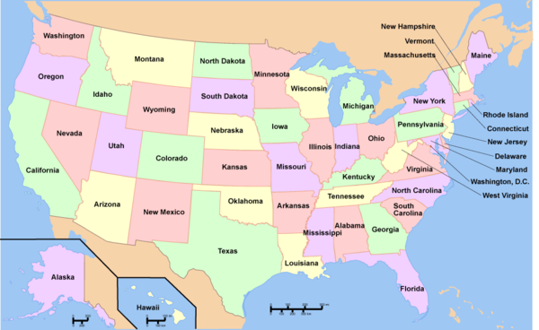
To see a listing of coal mines in a particular state, click on the map:

References
- ↑ Jump up to: 1.0 1.1 1.2 1.3 Buckskin Mining Company Kiewit, accessed October 2019.
- ↑ Excellence in Surface Coal Mining Reclamation Awards Winners: Active Mine Awards Office of Surface Mining Reclamation and Enforcement, accessed October 2019.
- ↑ "Notice of Availability and Notice of Hearing for the Buckskin Mine Hay Creek II Coal Lease by Application Draft Environmental Impact Statement, WY" E-docket, March 12, 2010.
- ↑ "BLM rejects Kiewit's $35.1m bid for new Buckskin coal tract" Transmission Hub, Sept. 19, 2013.
- ↑ "Buckskin Mine lays off 45, as coal jobs continue to disappear", Casper Star Tribune, 14 June 2016.
- ↑ Buckskin Mine, Mining Data Online, accessed June 2019.
- ↑ "New coal reserve for Kiewit's Buckskin mine nears a BLM auction" Transmission Hub, May 7, 2013.
External links
- "Major U.S. Coal Mines," Energy Information Administration