Buffalo Mountain Mine
|
This article is part of the Coal Issues portal on SourceWatch, a project of Global Energy Monitor and the Center for Media and Democracy. See here for help on adding material to CoalSwarm. |
The Buffalo Mountain Mine is a proposed 2,308 acre mountaintop removal mine by CONSOL Energy between Belo and Delbarton in Mingo County, West Virginia.
Contents
Location
The mine is located three miles northwest of Delbarton, Mingo County, West Virginia.
Background
In 2009, Governor Manchin asked the EPA to approve a permit for the mine. The mine is considered another step towards completion of the King Coal Highway, designed to be 95 miles from Bluefield to Williamson, eventually joining a new interstate highway connecting Michigan to Myrtle Beach. To build the highway, state officials are allowing coal companies to use mountaintop removal to prepare the roadbed.
The EPA has signaled it has concerns with the project: On the day President Obama was inaugurated, the EPA sent a letter to the Army Corps of Engineers, stating that the EPA believes that the "proposal will contribute to a violation of the State’s water quality standards downstream and that the direct and cumulative impacts from this and future mines and possible development associated with the King Coal Highway will be persistent and permanent.” The letter went on to say that the damage “cannot be sufficiently or effectively compensated through the proposed mitigation, therefore EPA must recommend denial of the permit as proposed.” Federal officials noted that the mine will bury nearly 10 miles of streams.[1]
In June the 2018 U.S. Environmental Protection Agency and the U.S. Army Corps of Engineers reached an agreement to develop the King Coal Highway, which will provide access to the proposed Buffalo Mountain Mine.[2] The highway is scheduled to be completed by November 2021.[3]
Project Details
- Owner:
- Parent company: CONSOL
- Location: Delbarton, Mingo county, West Virginia
- GPS coordinates: 37.7262069,-82.514269 (exact)
- Mine status: Proposed
- Start year: 2021
- Mineable reserves:
- Coal type:
- Mine size: 2,308 acres
- Mine type: Surface
- Production:
- Equipment:
- Number of employees:
Articles and resources
Related SourceWatch articles
- West Virginia and coal
- U.S. coal politics
- Coal and jobs in the United States
- Coal phase-out
- Headquarters of U.S. coal mining companies
- Global list of coal mining companies and agencies
- Proposed coal mines
- Existing U.S. Coal Plants
- Coal
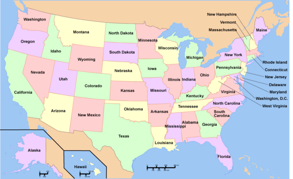
To see a listing of coal mines in a particular state, click on the map:
References
- ↑ Kan Ward Jr., "Obama EPA pushes state, company to reduce impacts of CONSOL’s huge Buffalo Mountain strip mine" January 26, 2012.
- ↑ Agreement reached to move King Coal Highway project forward, WVNSTV, Jan. 25, 2018
- ↑ Construction resumes on the King Coal Highway in Bluefield, Bluefield Daily Telegraph, May 1, 2019


