Jordan Grove Mine
| This article is part of the Global Coal Mine Tracker, a project of Global Energy Monitor and the Center for Media and Democracy. |
| Sub-articles: |
Jordan Grove Mine is a retired U.S. surface coal mine along the border of St. Clair County and Randolph County, Illinois. As of 2012, it has been repurposed as a coal combustion waste (CCW) fill site for the nearby Prairie State Energy Campus coal-fired power plant.[1][2]
Contents
Location
The below satellite image shows the location of the Jordan Grove mine—now the Jordan Grove CCW landfill—near Marissa, Illinois.
Background
The Jordan Grove mine site sits about three miles south of Marissa, Illinois. The mine tapped the same coal reserves as the former River King No. 6 mine, which was active in the 1970s and early 1980s, and produced about 100,000 tons of coal a year.[3]
Coal waste site
In 2010, the Prairie State Energy Campus began operations. Two disposal sites were approved to hold ash from the massive power plant: a spent coal mine site called the Randolph Preparation Plant, that has more than 500 acres of coal ash landfill space available and 22-year life expectancy, according to documentation submitted by Peabody Energy to the Illinois Environmental Protection Agency (EPA) in 2005; and another strip-mined area—the old Jordan Grove mine—having 953 acres available.[2]
According to a 2014 Illinois EPA document, given Prairie State's estimates that they will produce 3.9 million tons of coal combustion residuals and 350,000 tons of mine breaker reject per year, the Jordon Grove will reach capacity in less than 14 years. The lack of storage capacity at the Jordan Grove site does not meet the long-term disposal needs of the power plant, therefore additional capacity will be required to be located, purchased, designed, permitted and constructed in order to meet the requirements of the power plant. In addition to lack of capacity, the Jordan Grove site is located 19 miles by rail and 12 miles by road, from the Prairie State plant. This distance between the plant and the Jordan Grove disposal facility requires that the material be transported to the site by either rail (primary method) or truck (secondary method).[4]
Project Details
- Sponsor: Peabody Energy
- Parent Company: Peabody Energy
- Location: St. Clair and Randolph Counties, Illinois, United States
- GPS Coordinates: 38.2209294, -89.7771609 (exact)[5]
- Status: Retired[6]
- Production Capacity: 100,000 tons per year
- Total Resource:
- Mineable Reserves:
- Coal Type:
- Mine Size:
- Mine Type: Surface
- Start Year:
- Source of Financing:
Articles and resources
Related SourceWatch articles
- Coal and jobs in the United States
- Coal phase-out
- Headquarters of U.S. coal mining companies
- Global list of coal mining companies and agencies
- Proposed coal mines
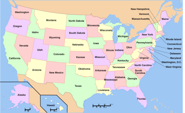
To see a listing of coal mines in a particular state, click on the map:
References
- ↑ Prairie State Update Presentation for Investors April 2012 American Municipal Power, accessed November 2019.
- ↑ 2.0 2.1 "Prairie State reverses course on Illinois coal ash site" Energy News Network, July 25, 2012.
- ↑ "Illinois Coal Is on a Comeback" RedOrbit.com, June 22, 2006.
- ↑ Public Notice/Fact Sheet for Antidegradation Assessment for Prairie State Generating Company Illinois Environmental Protection Agency, Dec. 19, 2014.
- ↑ Jordan Grove Landfill USA.com, accessed November 2019.
- ↑ "Mine proposed to be used as landfill" KFVS 12, June 13, 2007.

