Spring Branch 3 Mine
| This article is part of the Global Coal Mine Tracker, a project of Global Energy Monitor and the Center for Media and Democracy. |
| Sub-articles: |
Spring Branch No. 3 Mine is a proposed U.S. surface coal mine by CONSOL Coal Resources for Mingo County, West Virginia.[1]
As of November 2019, the project has not progressed in more than four years and appears to be cancelled.
Contents
Location
The map below shows an approximate location for the Spring Branch 3 Mine in Mingo County, West Virginia.
Background
Spring Branch No. 3 has been registered with the U.S. Mine Safety and Health Administration since December 2009, with the MSHA database showing it as a new mine with no production yet. The West Virginia Department of Environmental Protection issued the mine permit for Spring Branch No. 3 in July 2010.[2]
The proposed mining project was among dozens pulled for enhanced federal environmental reviews under a 2009 interagency agreement between the U.S. Environmental Protection Agency (EPA), the Army Corps of Engineers, and the Interior Department. Although Spring Branch No. 3 is an underground mine, the original application called for significant surface disturbances that would result in stream damage.[3]
The EPA stated that CONSOL agreed to changes that reduced the footprint of the surface disturbance for the deep mine from 57 acres to 19 acres, and would reduce linear stream impacts from 3,626 feet to 871 feet. This would cut back the amount of coal the company would mine from 2.85 million tons of coal to 2.77 million tons.[4] As a result of these concessions, in February 2011, CONSOL Energy reached a deal with the U.S. Environmental Protection Agency for a Clean Water Act Section 404 permit covering the company’s proposed mine.[4]
EPA said in its approval letter: "It is EPA’s position that this project has been substantially improved through significant new avoidance and minimization measures. Stream impacts have been reduced by nearly 76 percent and the total surface area of disturbance has been reduced by approximately 66 percent. Upon completion of operations, the applicant has agreed to remove all fill placed in waters of the U.S. and to restore affected streams to the pre-project condition. Notably, while the environmental footprint in waters of the U.S. has been significantly reduced, nearly 97 percent of the coal reserves that wee originally proposed for mining will be extracted under the applicant’s revised proposal."[4]
Project Details
- Sponsor: CONSOL of Kentucky, Inc.
- Parent Company: CONSOL Coal Resources, LP
- Location: Mingo County, West Virginia, United States
- GPS Coordinates: 37.7987664, -82.1582462 (approximate)
- Status: Cancelled
- Production Capacity: 2.77 million tons (projected)
- Total Resource:
- Mineable Reserves:
- Coal Type:
- Mine Size:
- Mine Type: Underground
- Start Year:
- Source of Financing:
Articles and resources
Related SourceWatch articles
- West Virginia and coal
- U.S. coal politics
- Coal and jobs in the United States
- Coal phase-out
- Headquarters of U.S. coal mining companies
- Global list of coal mining companies and agencies
- Proposed coal mines
- Existing U.S. Coal Plants
- Coal
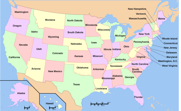
To see a listing of coal mines in a particular state, click on the map:
References
- ↑ "Surface Coal Mining Activities Enhanced Coordination Procedures - LRH-2009-00428" EPA, accessed February 2011.
- ↑ "CONSOL makes compromises, wins Section 404 mine permit from Army Corps" SNL Financial, Mar 1, 2011.
- ↑ "Company concessions clear way for federal permit at W.Va. mine" E&E News, Mar. 2, 2011.
- ↑ 4.0 4.1 4.2 "CONSOL makes deal, gets EPA permit approval" Coal Tattoo, March 1, 2011.

